I love bicycling and visiting the seashore. Fortunately, about a three-hour drive from the Washington, D.C., area where I live is a 70-mile stretch of coast where I can do both. It’s one of my favorite Mid-Atlantic biking getaways.
Places to bike here include seashore towns, beachfront boardwalks, a national seashore, a national wildlife refuge, a rail trail, and bike paths through marshes and forests and along some of the best beaches in the Mid-Atlantic. How’s that for diversity?
Listed below are the places I like to bike on this, the Delmarva Shore.
First a Little Geography
The region lying between Chesapeake Bay and the Atlantic is known, somewhat informally, as the Delmarva Peninsula, for the three states that share it (Delaware, Maryland, and Virginia). It is perhaps more often called the Eastern Shore, even though it really consists of the Delaware Shore (the state has no western shore) along with the Eastern Shore of Maryland and Virginia. But it’s all one continuous shore.
The seashore here extends from the mouth of Delaware Bay to the mouth of Chesapeake Bay. Most of it is on narrow barrier islands and peninsulas separated by bays from the mainland. These distinctive landforms front much of the Atlantic coast from Long Island to South Florida.

Much of the northern half is heavily developed. The two major developed areas are Rehoboth Beach to Dewey Beach and Bethany Beach to Ocean City. The two are separated by the narrow length of Delaware Seashore State Park.
The southern half, consisting almost entirely of Assateague Island, is completely different in nature. Assateague Island National Seashore, Assateague State Park, and Chincoteague National Wildlife Refuge share the island. Tucked next to the southern end is the island and town of Chincoteague. Except for park and refuge facilities, Assateague Island remains one of the most wild and unspoiled places on the U.S. Atlantic coast.
Cycling the Shore
It’s possible to bike from Lewes, Delaware, all the way to Chincoteague, Virginia. The Adventure Cycling Association has a mapped route you can follow, although it’s not hard to figure out one on your own. But it involves biking along some busy roads with fast-moving traffic, passing through a long and monotonous swath of beachfront development, and detouring inland for a long distance on often shoulderless roads. Not my idea of fun, but if you enjoy that kind of challenge, go for it.
I prefer to drive between my favorite spots and then park and bike. All the riding I describe below involves bike trails, boardwalks, local streets, or low-speed roads through the parks and refuge. The roads and trails can get crowded, especially on weekends or in summer, of course. But if you avoid the busiest seasonal, weekly, and daily timeframes, these can all be very relaxing and enjoyable rides.
Cape Henlopen State Park
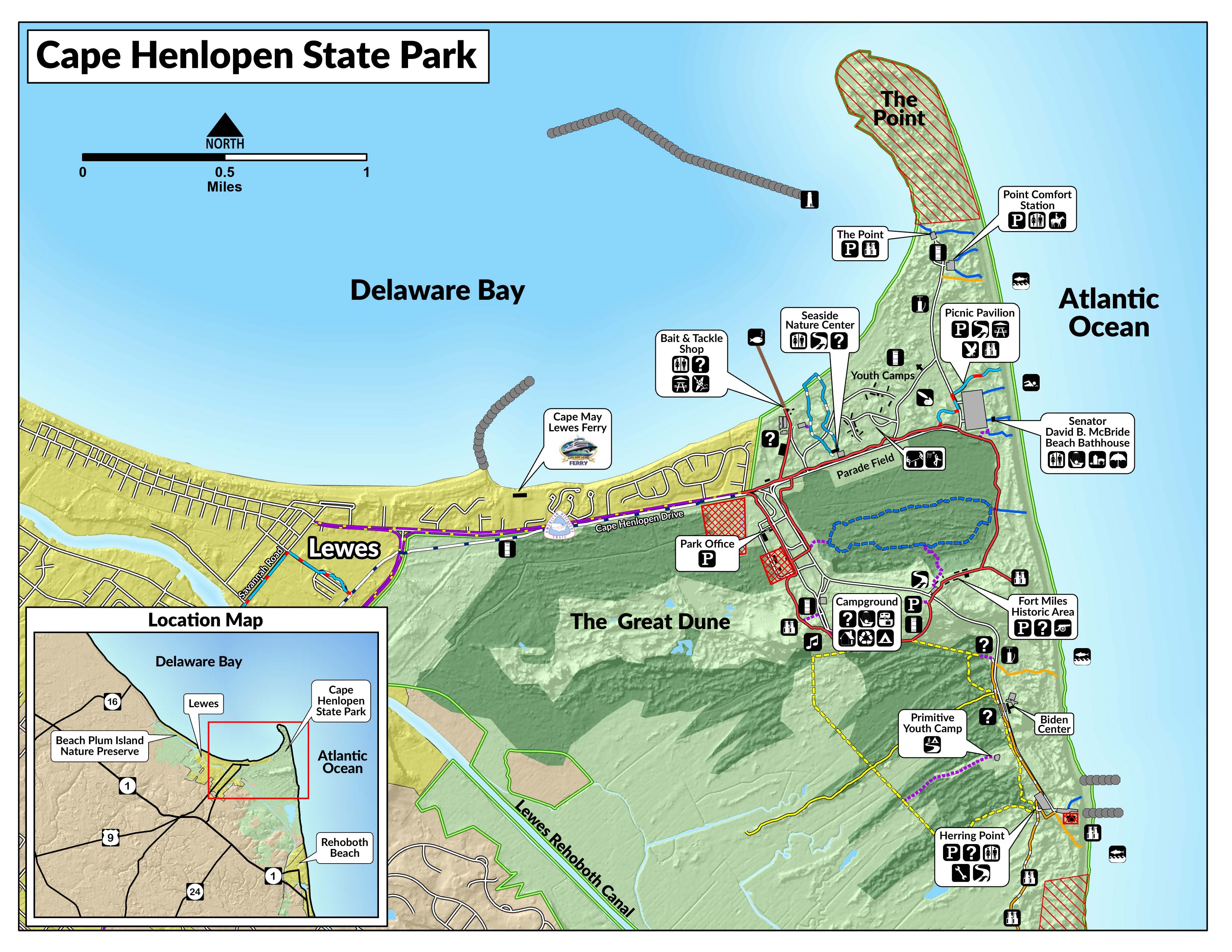
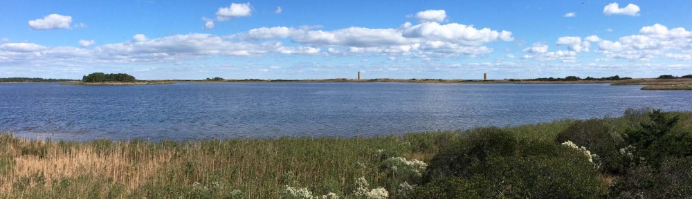
A former army base built to defend the entrance to Delaware Bay, Cape Henlopen is my favorite Delmarva state park. It has a small nature center; the Fort Miles Museum and Historic Area, including its large artillery collection displayed outside; and miles of largely unspoiled beach that extend to the outskirts of the town of Rehoboth Beach. The park has a huge campground, including one large loop with spacious and shady tent-only sites.
Cape Henlopen is a good starting point for several cycling excursions. First, there’s the park itself. You can get pretty much anywhere you want to go in this sprawling park on bike trails. The terrain varies from beach to marsh to forest, all studded with abandoned gun batteries, observation towers, and other military structures.
A bike trail extends from the park to adjacent Lewes and goes right by the landing for the Cape May Ferry. You can take the ferry across Delaware Bay to southern New Jersey, where you can bike to the Victorian resort town of Cape May and visit the lighthouse at Cape May Point State Natural Area, one of the prime birding destinations on the East Coast.


But that’s not all.
The Cape Henlopen–Rehoboth–Lewes Loop
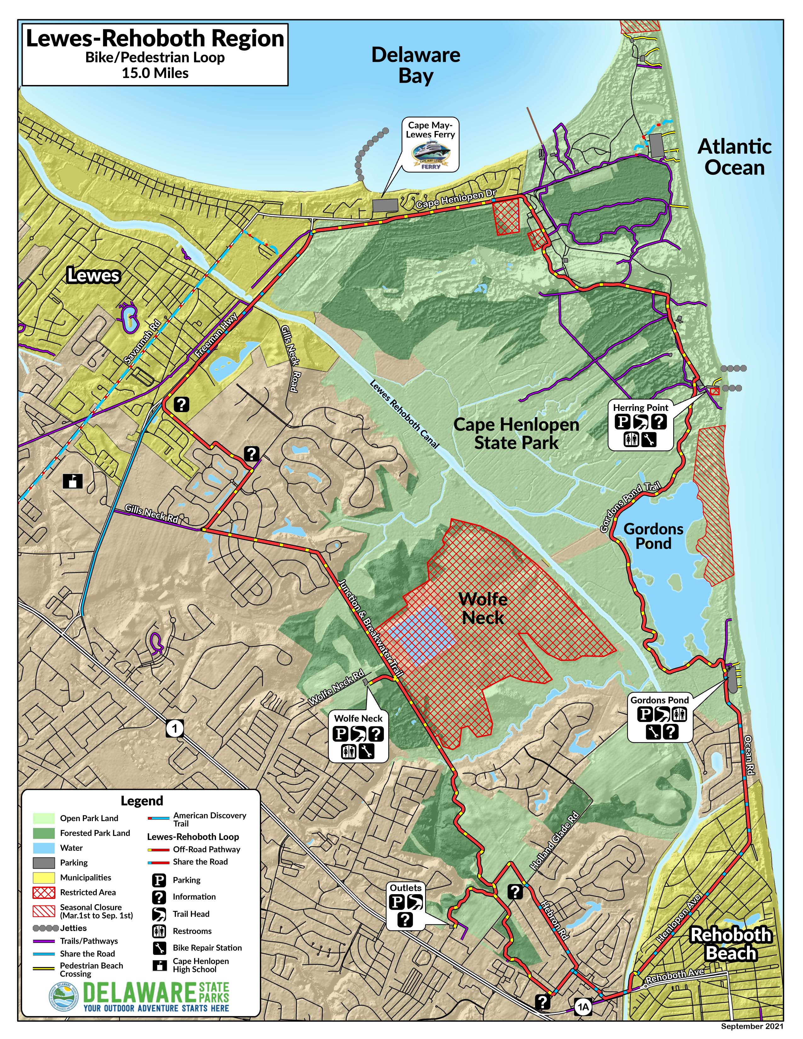
You can visit all the above (except for New Jersey) via a 15-mile cycling loop, mostly on trails, that takes you from Cape Henlopen State Park to Rehoboth Beach to Lewes and back. My favorite part is the beautiful 3.2-mile Gordons Pond Trail, which passes through forest, marsh, and dunes, partly on a raised boardwalk. You can extend your ride by biking down Rehoboth’s mile-long boardwalk or exploring the local streets. From May 15 to September 15, you can only bike on the boardwalk from 5 a.m. to 10 a.m.
The route from Rehoboth to Lewes is on the 5.8-mile Junction & Breakwater Trail. The rail trail surface varies from paved to crushed gravel and is a bit bumpy in a couple of spots. At its northern end you can easily detour into Lewes and explore that town by bike too. From Lewes it’s an easy ride past the ferry landing and back to the park on a wide and smooth trail.
The Ocean City Boardwalk
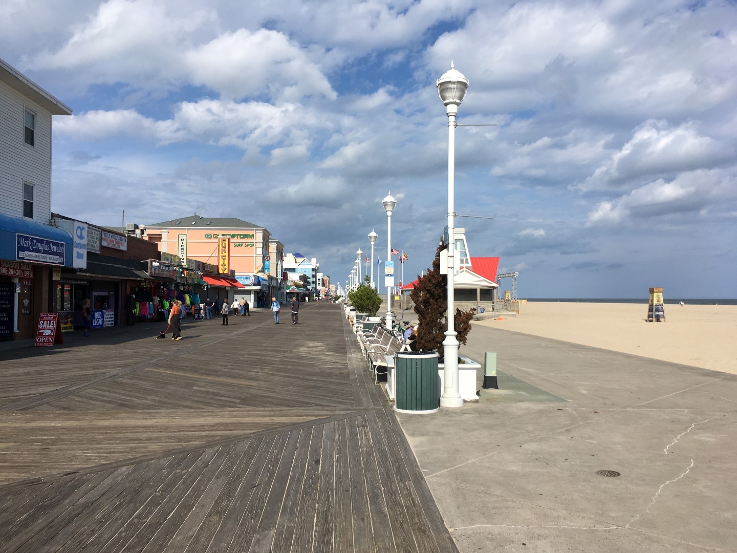
I much prefer Ocean City, New Jersey, to Ocean City, Maryland. But now and then, and only off-season, Sue and I drop by just to take a spin on its 3-mile boardwalk. It extends north from the Ocean City inlet to 27th Street. Most of it is quite wide, with an adjacent parallel concrete section alongside for a few blocks. It narrows at the southern end, where there’s an amusement park, public restrooms, the popular Thrasher’s French Fries, and the Ocean City Life-Saving Station Museum.
From Memorial Day to Labor Day, you can only bike on the boardwalk from 2 a.m. to 11 a.m. on weekdays and until 10 a.m. on Saturday and Sunday.
Assateague Island National Seashore
Assateague Island lies just a quarter mile south of Ocean City, separated by a narrow inlet. In fact, it used to be attached to Ocean City until the Great Hurricane of 1933 punched a channel between them. It might have ended looking more like Ocean City too, had a powerful nor’easter in 1962 put an end to that. Instead, it has been preserved, for the most part, in its natural state.
Assateague is very exposed and can get very buggy in places, and it is heavily visited at the usual times you’d expect. Biking here is mostly on dedicated paths or bike lanes, so you don’t have to worry much about traffic. Biking, I think, is the best way to see the island.
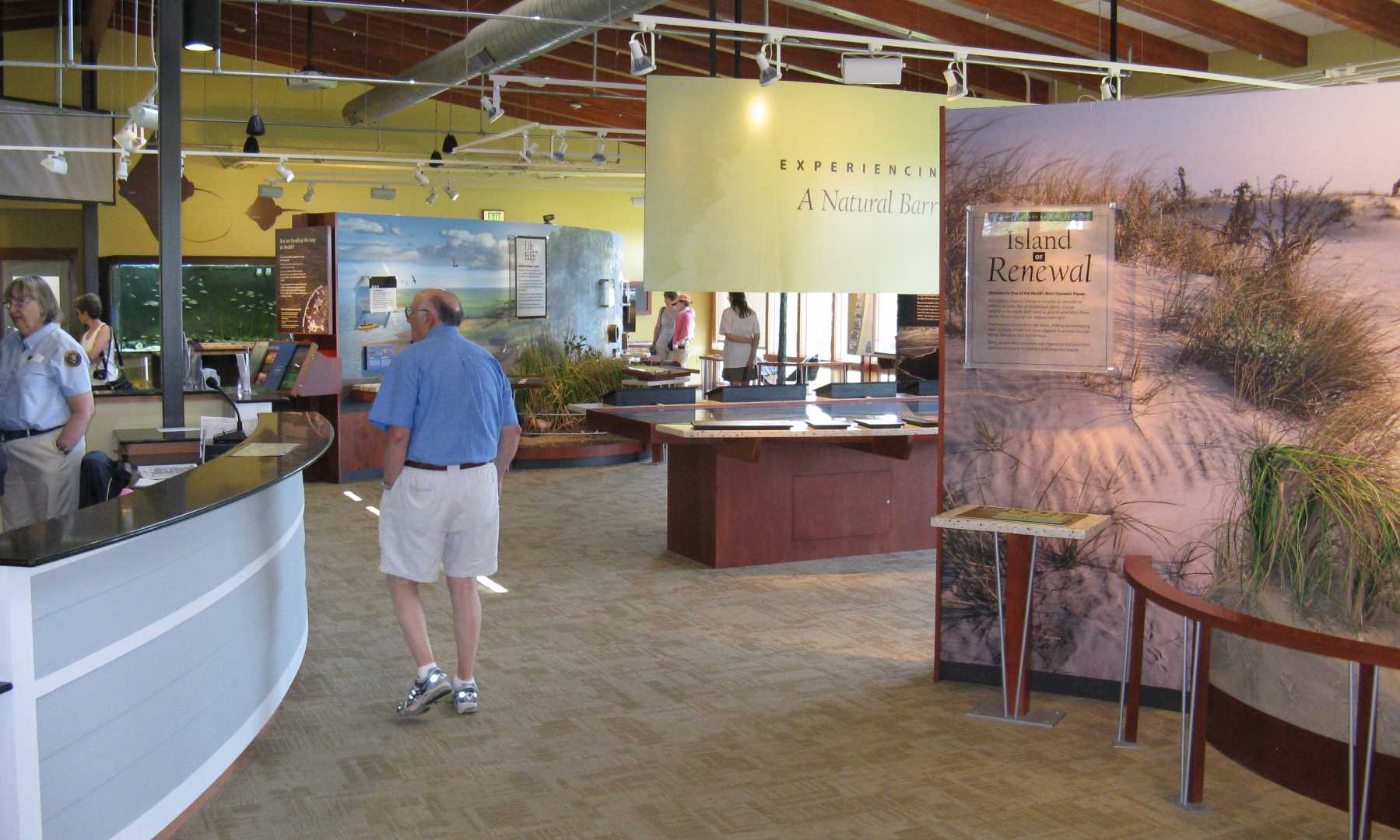
I would park at the Barrier Island Visitor Center, on your right just before the bridge to the island. It’s a nice facility with excellent exhibits on the human and natural history of the island. Unload your bicycle and head toward the island over the dedicated bike and pedestrian bridge across Sinepuxent Bay, one of the highlights of the ride and the only hill you will encounter.
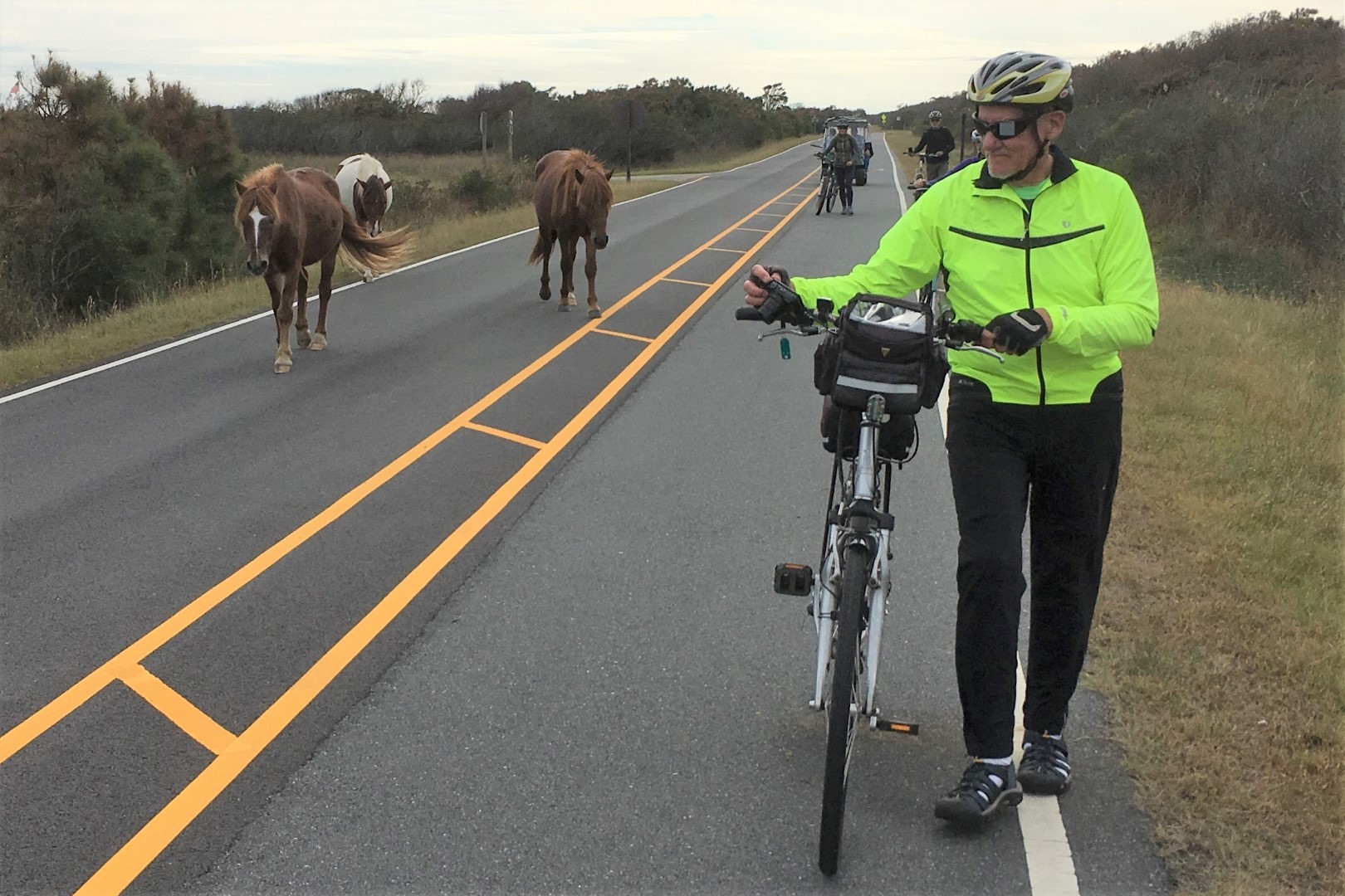
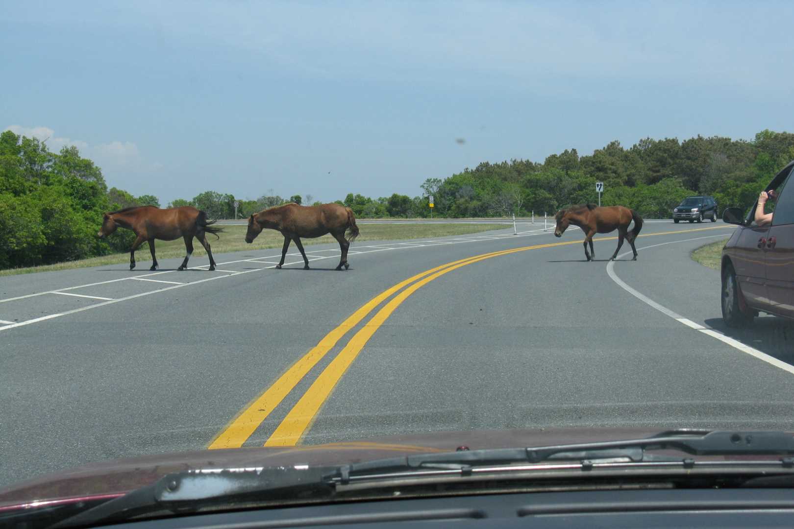
The bike trail from the visitor center to the far end of the road is only about 5 miles, but there is much to see along the way, including wild ponies, often at close range. Where the road ends, take a short walk up the Life of the Dunes Trail, where you’ll find one of the island’s most surprising features. I’ll leave it to you to discover.
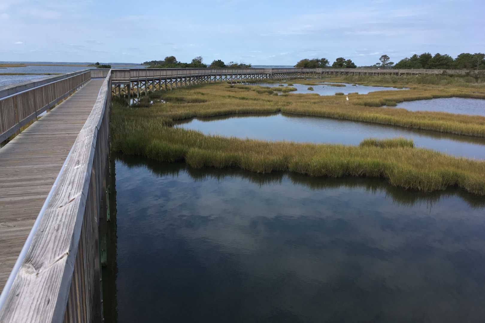
On your way back, you might detour up Bayside Drive to the Life of the Marsh Trail and its boardwalk over the marsh. There is also a third nature trail, the Life of the Forest Trail. And of course, there’s the beach. You can’t readily see it from the bike path, but it’s never far away, just a short walk over the coastal dunes.
You can’t bike the entire length of Assateague Island unless you do so on the beach, which I don’t recommend. (Think tides.) Alongside the national seashore is Assateague State Park. I haven’t been there in years and don’t recall much more than a large and unappealing looking campground and a heavily visited stretch of beach. One day I’ll check it out again.


There are many camping options in the state park and national seashore, from RV sites, to drive-in or walk-in sites close to the beach, to remote primitive backcountry sites you have to hike or canoe to. The nearest cluster of hotels is about 7 miles away just outside Ocean City.
From Assateague to Chincoteague
To go from Assateague to Chincoteague, you have to head inland. There are two routes, both similar in time and distance. You can either take US 113 past Snow Hill to Pokomoke City and then US 13 to Route 175. Or take the backroads route, Route 12/679 from Snow Hill to Route 175. Either works just fine.
The towns of Berlin, Snow Hill, and Pocomoke City are all worth short detours through their central areas. On Route 175, you’ll pass the visitor center for NASA’s Wallops Island Flight Facility, also worth a stop. If you’re staying in Chincoteague, be aware that there’s only one local grocery store. If you’re looking for something bigger, the nearest chain supermarket is the Food Lion at Route 175 and US 13, about 11 miles from Chincoteague.

The Town of Chincoteague
Unlike Rehoboth Beach and Ocean City, which developed as seaside resorts, Chincoteague started as a working town, especially for the seafood industry, and was famous for its oysters. Chincoteague is a much more low-key place than Rehoboth or O.C., which is not to say that it doesn’t get crowded in season. Chincoteague now serves mainly as the gateway to the wildlife refuge.
You can park your car here and bike to pretty much anywhere in town, although entirely on streets. A short distance past the traffic circle on Maddox Boulevard, you can bike onto the Chincoteague Marsh Boardwalk, which takes you into the wildlife refuge and past its admission booths. No charge for cyclists entering the refuge or the national seashore.
There are many places to stay, from chain hotels to independents. Sue and I favor the Island Resort. All the rooms have balconies with unobstructed views of the bay and great sunset vistas. Our favorite alternative is the Refuge Inn, set among trees just a tenth of a mile from the boardwalk.
Chincoteague National Wildlife Refuge

The refuge has more than 7 miles of paved trails open to cyclists. About the only place you can’t avoid biking on a road with traffic is the final mile of Beach Road heading to the shore.
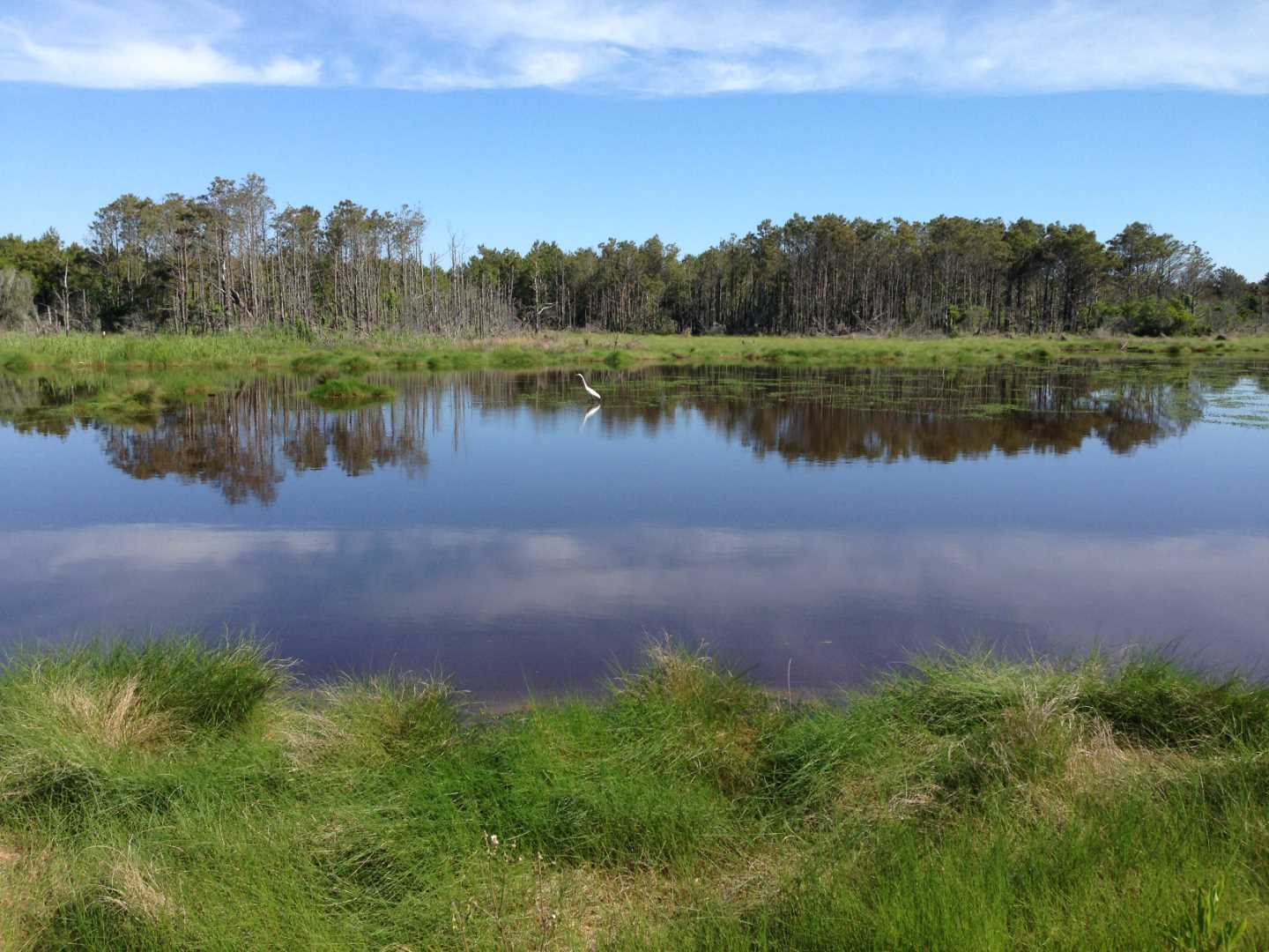
Soon after you enter the refuge, you reach the parking lot and entrance for the Wildlife Loop. This fine 3.2-mile road takes you through a diverse landscape and one of the best birding areas on the entire island. Best of all, it is car free for most of the day. Motor vehicles are only allowed from 3 p.m. to dusk. A short spur trail leads to the beach. A bikeable section of a service road leads to a more remote section of the beach.
Other worthwhile off-loop places to visit are the Chincoteague Lighthouse and the paved and bikeable Woodland Trail loop. The Fish and Wildlife Service’s Bateman Center / Refuge Visitor Center has some good exhibits and is also a nice central place to park. The National Park Service’s Tom’s Cove Visitor Center is smaller but right near the beach.
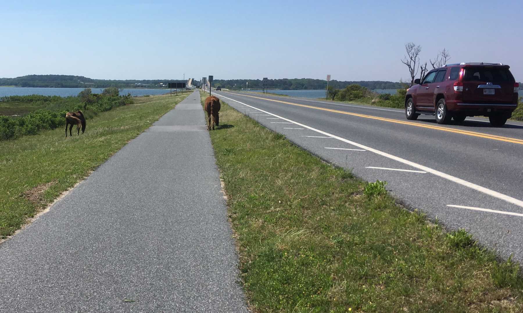
You are not as likely to get closeup views of ponies here as at the national seashore. They are restricted to a couple of large, fenced enclosures. You are most likely to see them from Beach Road or the observation point on the Woodland Trail. We once ran across several apparent escapees on the Wildlife Loop, but that was unusual.
You can easily spend the better part of a day poking around in the refuge before heading back into town. As with the national seashore, in warmer weather the insects can be ferocious in marshy areas. Mosquitoes once drove us away from the Wildlife Loop in late May, and biting flies forced us into a running retreat on the Bivalve Trail to Tom’s Cove. So, beware.
I hope to spend a lot more time on Assateague Island this year, so I may have more to say later about some of these places and more photos too.
Some Useful Links
Cape Henlopen State Park
Cape Henlopen-Lewes-Rehoboth Loop Map
Assateague Island National Seashore
Chincoteague National Wildlife Refuge
Adventure Cycling Delmarva Map
Related Posts
These posts feature more photos, mostly of Cape Henlopen, short descriptions of nearby Delaware Botanic Gardens and Maryland’s Cross Island Trail, and a couple brief attempts at more artful prose. Campsite 80, mentioned in “Picture Perfect,” no longer exists as such. The campground sites at Cape Henlopen have since been reconfigured and renumbered.
2020 To the Shore, At Last
2020 Picture Perfect: Cape Henlopen
2016 Return to Cape Henlopen
2015 Gallery: Cape Henlopen
2015 On the Beach at Cape Henlopen
David Romanowski, 2024
