I have taken many long-distance cycling trips since I became interested in bicycle travel. But I hadn’t done the one thing I’d really wanted to do all along: roll my bicycle out of my back yard in Bethesda, Maryland, and bike to somewhere far away.
I live close to the C&O Canal National Historical Park, so the canal towpath is a perfect option for a cycling excursion from home. I visit the towpath often to walk or bike, and I’ve bicycled its entire length twice. I’ve always thought a trip from home to Harpers Ferry, West Virginia, via the towpath, with a side trip from Harpers Ferry to Antietam National Battlefield near Sharpsburg, Maryland, would make a perfect three-day bicycling trip.
During a stretch of unseasonably warm weather this past October, I finally ran out of reasons to put off this trip. I made a two-night reservation at a bed and breakfast in Harpers Ferry, loaded clothing, supplies, and snacks into one of my touring panniers, and headed for the canal.
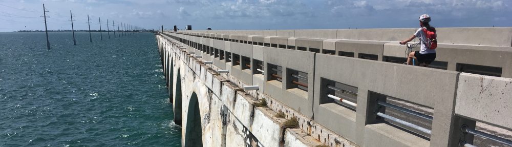
(Mile markers appear along the towpath at one-mile intervals and provide a handy reference for describing locations along the canal, as in the captions below.)

Biking along the edge of the world: fog on the Potomac River.

Mile 13: The beautiful Widewater section of the canal in the morning fog.

Mile 35.5: White’s Ferry remains a busy river crossing. The Gen. Jubal A. Early (named after a Confederate general) is the last ferry still operating on the Potomac River.

Mile 39.4: A gigantic silver maple shades Lock 26, the trunk wider than the length of my bike.

Mile 42.2: The restored, 560-foot-long Monocacy Aqueduct is the longest aqueduct on the C&O Canal. I would cross five aqueducts on this trip.

Mile 51.5: The Catoctin Aqueduct, with its unusual elongated center arch, was mostly collapsed by 1973. Since restored, it reopened in 2011

Mile 60.7: Trains often pass through the B&O Railroad tunnel and across the bridges at Harpers Ferry, which is on the opposite side of the Potomac from the canal. To reach town, you climb a wide spiral staircase here and take the walkway on one of the bridges.
Harpers Ferry occupies the strategic point of land where the Potomac and Shenandoah rivers merge. Once an industrial town, it became known for John Brown’s raid on the federal arsenal here in 1859, an event that helped incite civil war a year and half later.
Union and Confederate troops traded control of the town throughout the Civil War. After the war, severe floods helped end industry here. Much of Harpers Ferry is now a national historical park managed by the National Park Service.
Harpers Ferry itself is well worth a visit. However, I’d visited many times before, so I didn’t do any exploring. But staying overnight at the Stonehouse Bed and Breakfast was a first for me.

The view down the Potomac River from Harpers Ferry, where the Shenandoah River flows into the Potomac from the right.

I stayed in the cozy top floor room at the Stonehouse B&B, conveniently located in the lower part of Harpers Ferry, just steps away from the national historical park.

One side of my room faced the Amtrak train station and railroad tracks, used frequently by both passenger and freight trains. I could hear their horns all night long. The earplugs I wore on the second night helped a lot.

The view from my room in the other direction toward Washington Street, which heads steeply uphill.

As I crossed the Potomac in the morning to return to the towpath, the low sunlight lit up countless spider webs on the railroad bridge.
The next morning I biked another 12 miles up the canal towpath to Boonsboro Pike (Maryland Route 34), and then another easy 4½ miles on roads to the Antietam National Battlefield visitor center near Sharpsburg, Maryland.
Antietam preserves the grounds of the exceedingly costly Civil War battle that took place here on September 15, 1862. By the end of 12 hours of fighting, about 23,000 soldiers were killed, wounded, or missing. It was the single bloodiest day in American history.

A focal point of the fighting, the small, white Dunker Church (in the background, a reconstruction of the original) appears prominently in a famous photo taken at the time of the battle.

The Mumma Cemetery, a family burial ground in the midst of the battlefield, contains graves of local people dating back from before the battle to the present.

The observation tower, built long after the battle along the Sunken Road, marks the site of some of the day’s heaviest fighting.

Split-rail fences border the farm fields around Sharpsburg, a calm and quiet countryside that for one day in 1862 was transformed into hell on earth.

Cannons overlook the Burnside Bridge, another battlefield landmark, where for three hours a few hundred Confederates held off a much larger Union force trying to cross the bridge.

Antietam National Cemetery contains the graves of 4,776 fallen Union soldiers. Confederate soldiers were buried elsewhere, in nearby Hagerstown, Frederick, and Shepherdstown.
I headed home the next day, retracing my route down the canal. I had biked almost 75 miles from home to my farthest point in Antietam, and a total of 162 miles over three days.

Mile 30.9: The lock and ruins at Edwards Ferry mark the halfway point between Harpers Ferry and home.

The Widewater section of the canal again, less than a dozen bicycling miles from home.
David Romanowski, 2016


Reblogged this on historyplaces and commented:
My friend and former writer for the Smithsonian, David, writes a great blog about his biking and other adventures. Here’s a recent post he wrote about a bike trip to one of my favorite history places, Harpers Ferry, West Virginia. Be sure to check out some of his other posts.
LikeLike
Hi David, I live in NYC but want to see Harpers Ferry and Antietam, with a side trip to Shepherdstown. I was going to visit a friend in DC/ Arlington maybe rent a bike from there, oi do want to see some of the local DC bikeways. I do wan to see harpers Ferry and the battlefield late summer or early fall.
good write.
LikeLike
Hi Patrick. Thanks for your comment! All the places you mentioned are well worth visiting, especially if you are interested in Civil War history. Bicycling, I think, is the best way to explore Antietam; you just follow the driving tour route on the Park Service brochure. Harpers Ferry and Shepherdstown are best explored on foot but are easily reachable by bike from the C&O Canal. If you want advice on the C&O, or other biking trails or destinations in the DC area, feel free to get in touch.
LikeLike
Thanks David,
sorry i didn’t et back to you sooner. will probably take train down from DC to Harpes Ferry stay there and explore for a few days with Antietam and Shepherdstown on the agenda. 9 side venu for bilking?)
Thanks
LikeLiked by 1 person
Hi David,
yes I would very much like information on the C&O and other biking trails the DC area.
Thank You
some of the blogs are amazing. looking for a solo trip but seeing friends in the dc area.
LikeLike
Hi Patrick,
The D.C. area has a far-reaching network of off-street bike routes that go all over the place. From Washington or Arlington, you can take a very scenic trail south along the Potomac River from Roslyn in Arlington, past National Airport, through charming Old Town Alexandria, and on along the river to Mount Vernon, about 17 miles one way. Partway down that trail, you can detour to the west on the W&OD rail trail and bike 40-some miles into Virginia to Purcellville. Or you can cross the river into D.C. and bike 20-some miles north through Rock Creek Park and up into Maryland, as far as Lake Needwood near Rockville. Or you can pick up the C&O Canal (or the parallel and paved Capital Crescent Trail for a few miles) in Georgetown and bike 185 miles west to Cumberland, MD, and continue another 150 miles or so to Pittsburgh, PA. All those routes converge in D.C.
And the National Mall area in the middle of the city is an excellent area to explore by bike as well. There are lots of options. For many reasons, a bicycle is perhaps the best way to explore Washington. As long as you stay off the trafficked roads, which is easy to do.
Currently, I volunteer at the National Park Service visitor center on the C&O Canal at Great Falls (near Mile 14) on most Wednesday afternoons (12:30 to 4:00). If you wander by, feel free to stop in and look me up.
What’s the timeframe for your visit?
David
LikeLike